Land is important. It sustains us and shapes us. And I know that if someone wanted to know my heart they would need to know the places I love. With populations becoming more urbanized and globalized perhaps connection to the land is changing, but our reliance on it and it’s effect on us are always there.
At the beginning of a social studies unit I think it makes sense to spend some time with maps to try to understand a people or event. My daughter is at the beginning of her grade 3 social studies unit studying the Inca in 1500 (as we are homeschooling in Québec we have to follow the provincial curricula).
I was looking for a tactile mapping project and decided on a salt dough map. My daughter really enjoyed this project. In case you want to try it with your kids or class, here are the steps we followed:
1. Get a piece of plywood. You could also try using cardboard or anything not too floppy.
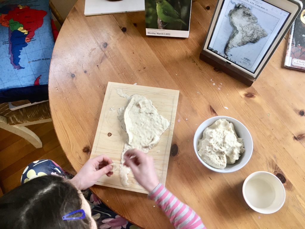
2. Using google maps (or another map) draw the outline of the continent (or whatever geographic area you are studying) on the plywood. You could also print and glue down an map or do a tracing of a template, but I think having to draw it adds to the overall understanding.
3. Make the salt dough. We used roughly 2C flour, 1C salt & 1C water – start with 1C of flour and keep adding until you get a good consistency (it made enough dough for 2-3 maps so we could of halved it, but my daughter used the extra to make little animals etc.). If you aren’t using it right away you’ll need to put it in an air tight container.
4. Find a relief map of the area. I did a google image search for “relief map of South America” to find the one we used.
5. Push the dough down wherever the land is and then use more to create the relief. My daughter started by covering the whole continent with a thin layer of dough and then began to build up the mountains.
6. Let the dough dry. You can begin painting the non-dough parts of the map while you wait for the dough to dry. My daughter painted her water and border areas right away. We let the dough dry for a day.
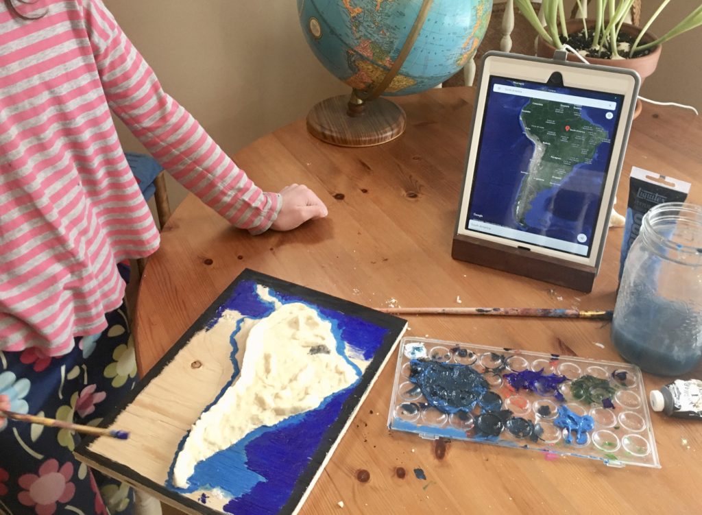
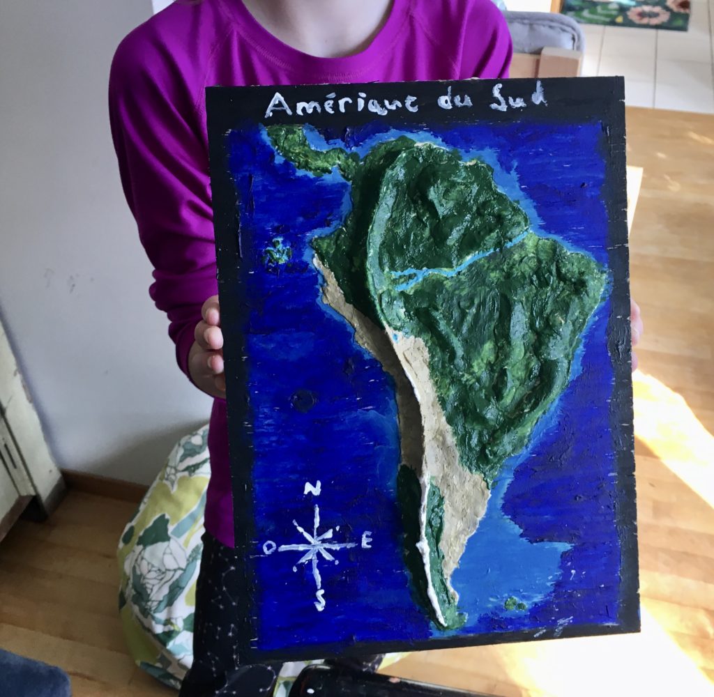
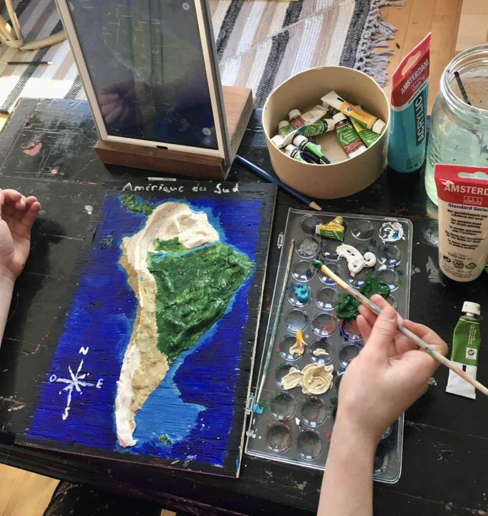
7. Use google maps (satellite view) to help paint the map. We used acrylics and a colour scheme to match the google maps satellite image (i.e. light blue to show shallower water and darker blue for deeper water, green for forest, white for snow or glaciers, and beige for the drier/less vegetated land). Add a title and compass rose (and whatever else you want to add).
For another tactile geography project, check out the Paper Mache Globe blog post.
Every history unit we have studied this year, my daughter has asked, “Why does there always have to be so much fighting?”. I don’t know. We are wishing for peace all over this hurting world right now and in the future.
Kate